It was fascinating to see how the battle played out and over such a spread out area. So, many mistakes were made on Custer's part. He underestimated his enemies, their will to protect their way of life and the number of that were encamped along the Little Big Horn River
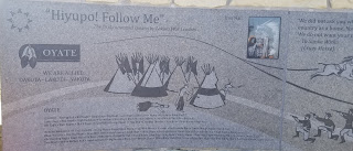
Below, you will not only find the pictures of the plaques that explained how the battle played out but you will see the historical places where the bodies fell. So many were disfigured that their bodies were not identified.
Throughout the battle, bodies fell all over the battlefield. They were buried in shallow graves with tipi poles to mark the graves, until nearly 5 years later, Granite markers were placed were the dead fell and all the bodies were dug up and placed under one very large Granite marker.
JUST TAP ON THE PICTURES TO READ THEM.
SIGNS ALONG THE WALKWAY AND
ALONG THE 5 MILE ROAD THAT COVERED
THE AREAS OF THE BATTLEFIELD
NATIVE AMERICAN MEMORIAL WALL
The Native names that are listed
were very interesting to read. I was also amazed with how many different tribes were involved;
it wasn't only the Souix.
WE HAD SO MUCH FUN WITH OUR FRIENDS
THE UTTERS
Jamie, Ruth and Lacey
THESE WERE MARKERS IN THE FIELDS
Soldiers are marked with white granite markers,
And the Natives were marked with red granite markers. There was even a marker for the
horses that died.
This is Last Stand Hill. Custer's marker is
the black one
Part of the 5 mile road mentioned above
View of Little Bighorn River
THEN WE TRAVELED NORTH OF BILLINGS
TO POMPEY'S PILLAR
This is the only physical proof along the Lewis and Clark Trail that William Clark was there besides his journals.
Pompey (Pom-Pee) is a Native word for frolicking child. William Clark named this Pillar of rock after Sacagawea's son.
The Plaster below is a copy of the real signature on the pillar.


No comments:
Post a Comment